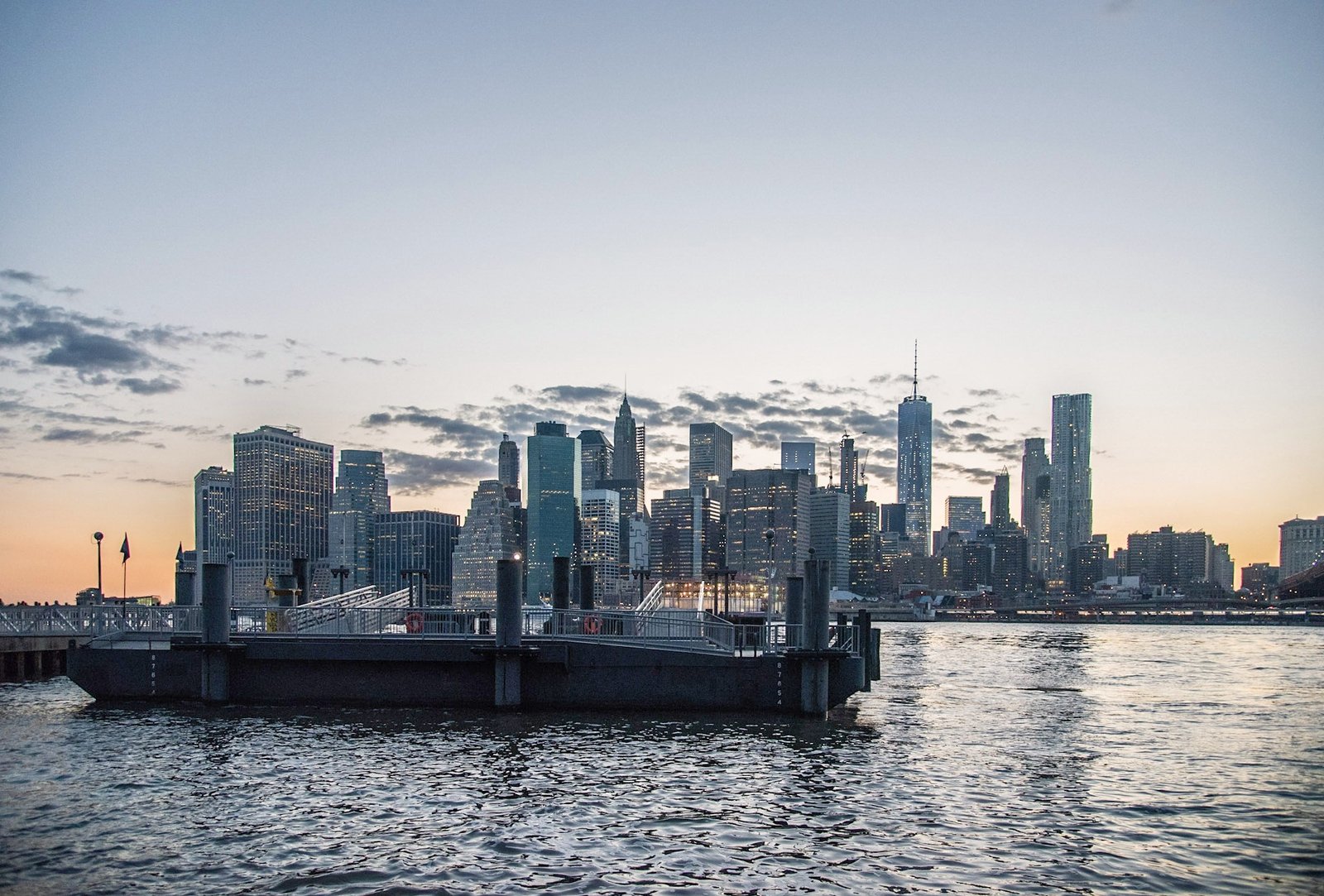
Continue along the waterfront with DUMBO After Sunset: Boats, Bridges and Manhattan Lights, a companion photographic story from the May 2016 archive.
Original photography and personal reflections by A. Abbady. Photographs in this collection were made in May 2016; historical and visitor references checked October 2026.
Looking beneath Brooklyn Bridge toward Manhattan Bridge at dusk.
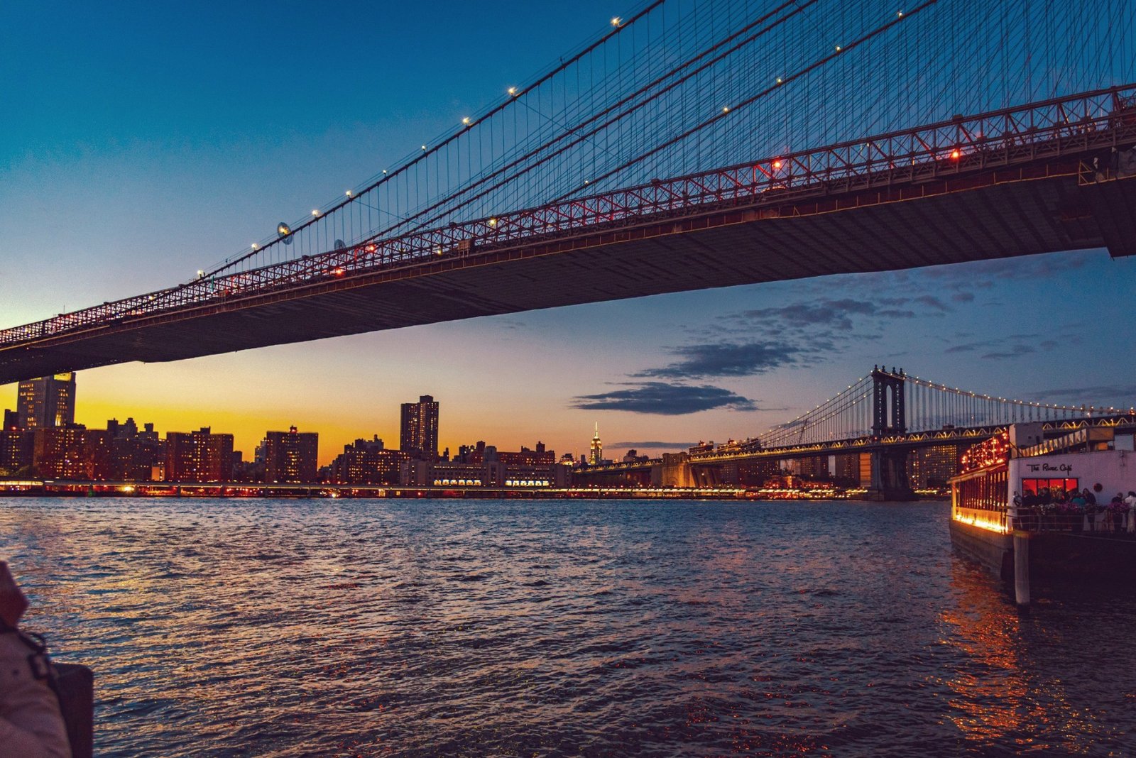
Looking beneath Brooklyn Bridge toward Manhattan Bridge at dusk. Photograph by A. Abbady, May 2016.
Explore 15 distinct views of DUMBO and the Brooklyn waterfront using the gallery arrows above.
DUMBO is one of my favorite places in New York City. I return to this part of Brooklyn to photograph the sunset, watch the light change across the East River, and see the bridges and Manhattan skyline take on a different character as evening becomes night. The view is familiar, but it never feels finished. Another cloud, a passing boat, or a new reflection can give me a reason to make another photograph.
This collection follows that feeling of returning. It brings together the broad skyline, the two bridges, waterfront paths, old brick walls, illuminated arches and neighborhood streets. Some images are quiet; others carry the movement of people and water. Together they describe an evening in a neighborhood whose beauty comes from the meeting of engineering, industry, public space and everyday life.
Where DUMBO Is—and What Its Name Means
DUMBO stands for Down Under the Manhattan Bridge Overpass. It is a Brooklyn waterfront neighborhood beside the East River. The area between the Brooklyn and Manhattan Bridges is its best-known section; the neighborhood also extends east of the Manhattan Bridge toward Vinegar Hill. [9] The named neighborhood, the legally designated historic district and Brooklyn Bridge Park are related places, but their boundaries are not interchangeable.
For a first visit, the two bridges provide the simplest orientation. The Brooklyn Bridge’s masonry towers identify one end of the familiar waterfront panorama. The Manhattan Bridge’s steel structure identifies the other. Between them, streets and former industrial buildings meet the river. Turning inland reveals a different DUMBO: large windows, deep building façades, stone paving and the smaller details that are easy to miss when looking only at the skyline. [1,2]
A Waterfront Built for Work
Long before these views became favorite photographic subjects, the shoreline supported movement, trade and manufacturing. Ferries carried people across the river, while warehouses and factories depended on access to the water. This was an active workplace, connected to a much wider commercial world. The river that now creates a foreground for evening photographs was also a route for goods and livelihoods. [3]
Looking at the waterfront with that history in mind changes the meaning of the surviving buildings. Their large scale was practical. Repeated windows brought light into working interiors; substantial walls enclosed spaces intended for storage and production. The streets were part of that system, linking buildings to one another and to the shore. A photograph of an old wall or rail fragment can therefore be more than a study of texture: it can preserve a small clue to the way the neighborhood once functioned.
Factories, Packaging and Industrial Architecture
DUMBO’s industrial past involved many kinds of work. Machinery, paper boxes, printing and food-related businesses were among the activities that shaped it. Robert Gair’s packaging enterprise became an important presence, and its buildings helped establish the district’s industrial identity. The Landmarks Preservation Commission’s detailed designation report documents this history building by building. [1]
The architectural lesson is visible without needing to identify every factory. Compare the long rows of windows, the weight of brick façades and the more regular grids of concrete structures. These are different ways of organizing space for work. For a photographer, their repetition supplies rhythm. A pedestrian, a doorway or a parked vehicle interrupts that rhythm and restores a human scale. The strongest street photographs often hold both ideas at once: the size of the industrial city and the individual life continuing within it.
Reading the Streets Beneath Your Feet
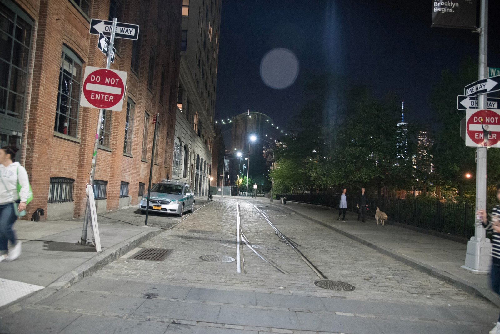
The neighborhood’s stone paving is often casually called cobblestone. The historic district report also identifies Belgian-block surfaces and surviving rail tracks. Those distinctions matter because the ground itself belongs to the industrial story. It was designed to carry traffic and connect working buildings, not simply to create an attractive background for visitors. [1]
In photographs, the rails and paving offer another way into the scene. Lines lead toward the river; uneven surfaces catch small pools of light; the dark base of a building contrasts with a brighter street. Near nightfall, it is worth looking down before making the next skyline picture. A composition that begins with the ground can explain how the neighborhood is put together, giving the distant bridge a setting rather than letting it float above an anonymous foreground.
The Brooklyn Bridge: Stone, Cables and a Changing City
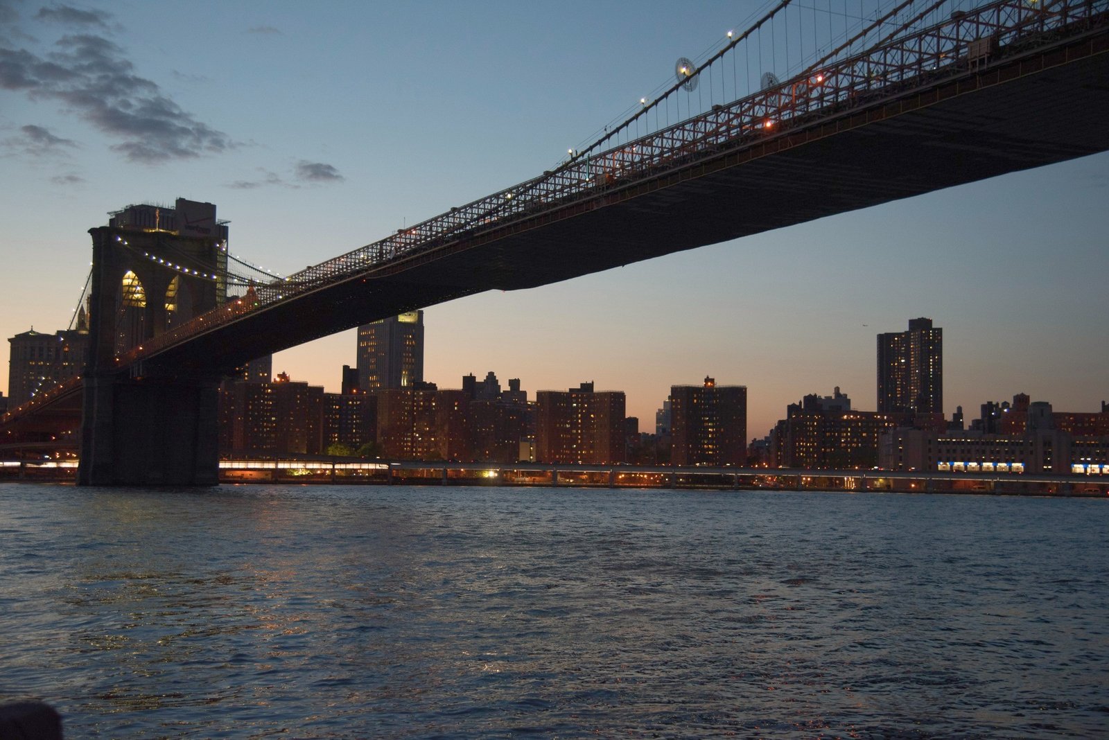
The Brooklyn Bridge opened to the public on May 24, 1883. Designed by John A. Roebling, it was the world’s longest suspension bridge when completed. Its construction created a permanent connection across the East River between Brooklyn and Manhattan, transforming the relationship between the two shores. The familiar towers are therefore both architectural landmarks and reminders of a major change in how the city moved. [4,5]
From the Brooklyn waterfront, the bridge offers several different photographs. A close view emphasizes the tower and cable pattern. A wider view lets the deck cross the skyline. Move again and the stone mass can become a dark shape against the remaining light in the sky. None of these views cancels the others. The bridge is large enough to become a subject, a frame or a leading line, depending on where the photographer stands.
The Manhattan Bridge: A Different Kind of Presence
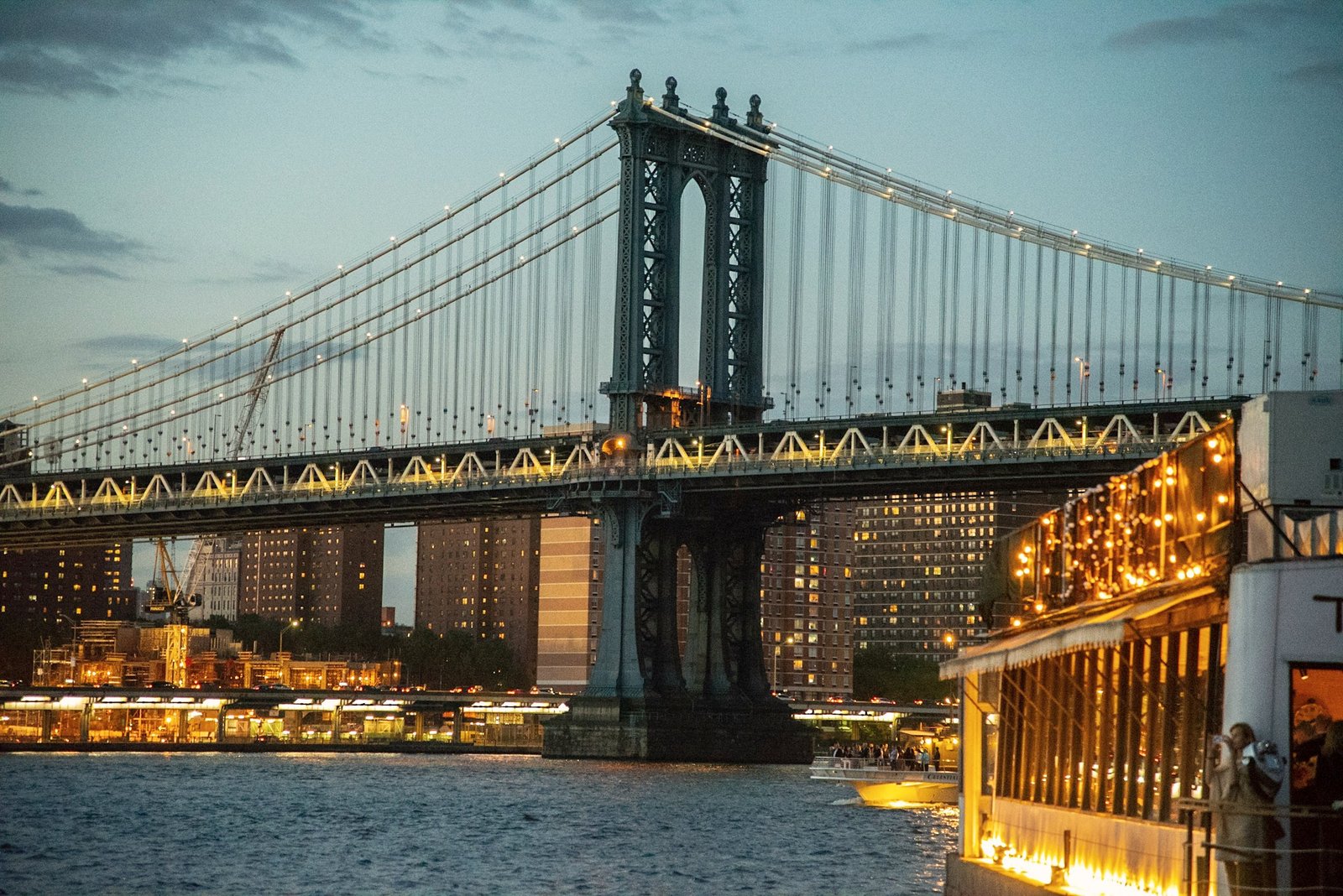
Completed in 1909, the Manhattan Bridge connects Chinatown in Lower Manhattan with Brooklyn. NYC DOT identifies Leon Moisseiff as its designer and describes its use of deflection theory as an important engineering development. Its steel structure, transport role and visual character distinguish it from the older Brooklyn Bridge. [6]
The difference becomes particularly clear from below. Where the Brooklyn Bridge’s towers appear heavy and monumental, the Manhattan Bridge presents a layered arrangement of steel, cables and deck structure. Its underside can dominate the upper part of a photograph, while the river remains open beneath it. Boats introduce another scale entirely. A passenger vessel in this collection introduces movement beneath the illuminated bridge, bringing the working river into the nighttime panorama.
Two Bridges, Two Visual Languages
It is tempting to think of the bridges only as landmarks to collect in separate photographs. A longer visit invites a more interesting comparison. Look at the weight of the towers, the shapes of the openings, the apparent thickness of each deck and the way the lights describe the suspended lines. The structures organize the waterfront differently, even when photographed under similar conditions.
That comparison is one reason DUMBO rewards a walk rather than a single stop. A bridge that fills one frame may be a distant accent in the next. Trees can hide part of a tower; a path can guide the eye toward it; an old building can place modern engineering against an earlier streetscape. The neighborhood supplies these changes of relationship within a relatively compact area. The photograph becomes stronger when it shows one of those relationships clearly.
Empire Stores and the Memory of Warehousing
The seven connected warehouses known as Empire Stores were built between 1868 and 1885. They stored a range of goods, with coffee especially important to their history. Brooklyn Bridge Park’s account describes their later decline and eventual reuse, a story that makes them a useful example of how a waterfront building can survive while its purpose changes. [7]
The visual interest lies partly in that continuity. Brickwork, openings and the scale of the building still suggest storage and trade, even as visitors experience a different kind of place. This is a useful distinction when looking through travel photographs: the appearance of an old building does not mean its interior use has remained the same. Nor should a construction fence visible in a 2016 image be read as a description of conditions today. The photograph records a particular moment in a much longer life.
Artists, Reuse and Historic Protection
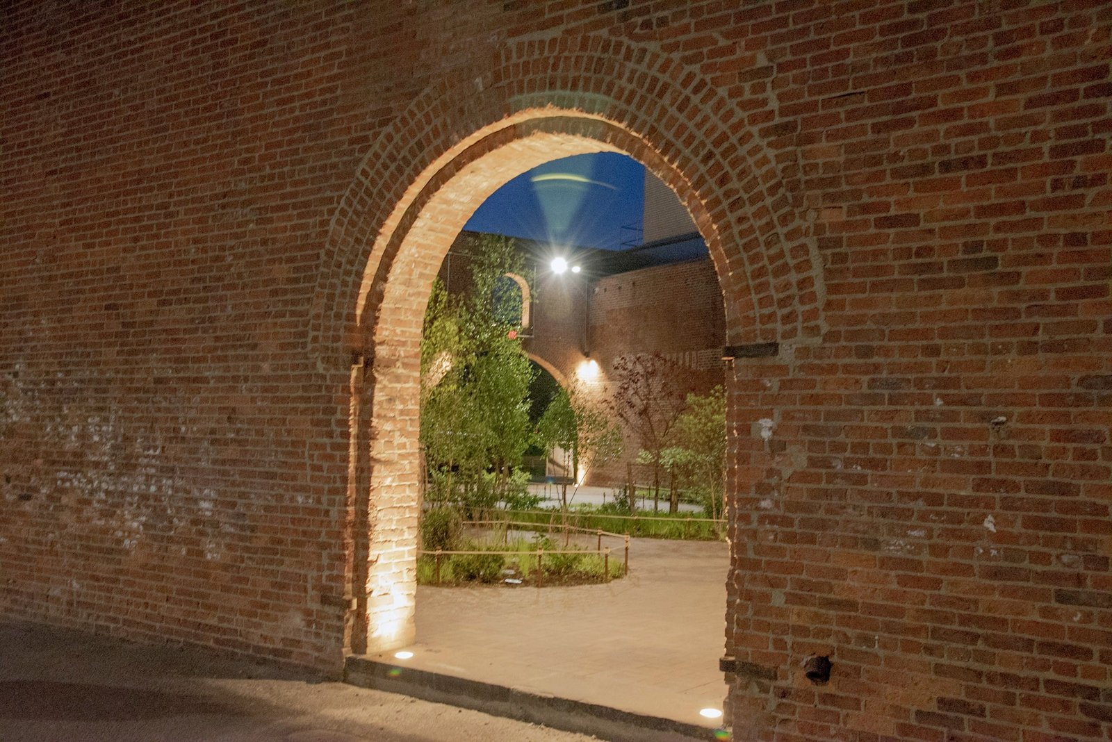
As industrial activity declined, former working spaces acquired new uses. Artists began moving into the neighborhood in the late 1970s, and the industrial buildings became part of a different cultural landscape. DUMBO’s designation as a New York City historic district followed in 2007, recognizing the importance of its architecture and industrial streetscapes. [2]
The change is not simply a story of attractive buildings being discovered. Reuse can preserve structures while changing who can afford to occupy them and how a neighborhood is experienced. A thoughtful photographic visit can hold those questions open. It can appreciate the public life and architectural survival without pretending that every consequence of transformation is simple. The old streets remain places where people live and work, as well as places visitors come to admire.
From Working Shoreline to Public Waterfront
Brooklyn Bridge Park’s history describes a long transition from commercial shoreline to public landscape, including community advocacy after cargo operations declined. That background is important: access to these views was shaped by decisions, planning and sustained public effort. The waterfront’s present role as a place to walk, rest and look across the river was not inevitable. [3]
In the photographs, the park provides more than a convenient viewing platform. Lawns, planted edges, benches and paths soften the scale of the bridges and buildings. People pausing by a railing make the panorama feel inhabited. A tree can create a dark border around a distant tower; a curve in the walkway can give the scene depth. These quieter elements help explain why a place built beside such large infrastructure can also feel personal.
Why I Keep Returning for Sunset
For me, the attraction is the change rather than a single perfect instant. Before sunset, the skyline may still read as individual buildings. As the light fades, their outlines become more important. Later, windows and bridge lights create a second structure over the dark forms. The river carries those changes into the foreground, breaking reflections into fragments.
I do not need every visit to produce the same sky. A restrained evening can reveal the bridge more clearly than a dramatic one. Clouds may add weight; an open sky may give the architecture room. The exact position of the setting sun changes through the year, and a familiar viewpoint does not guarantee that the sun will line up with a particular building or bridge. What remains dependable is the opportunity to watch carefully and respond to the light that is actually there.
Staying Beyond the Sunset
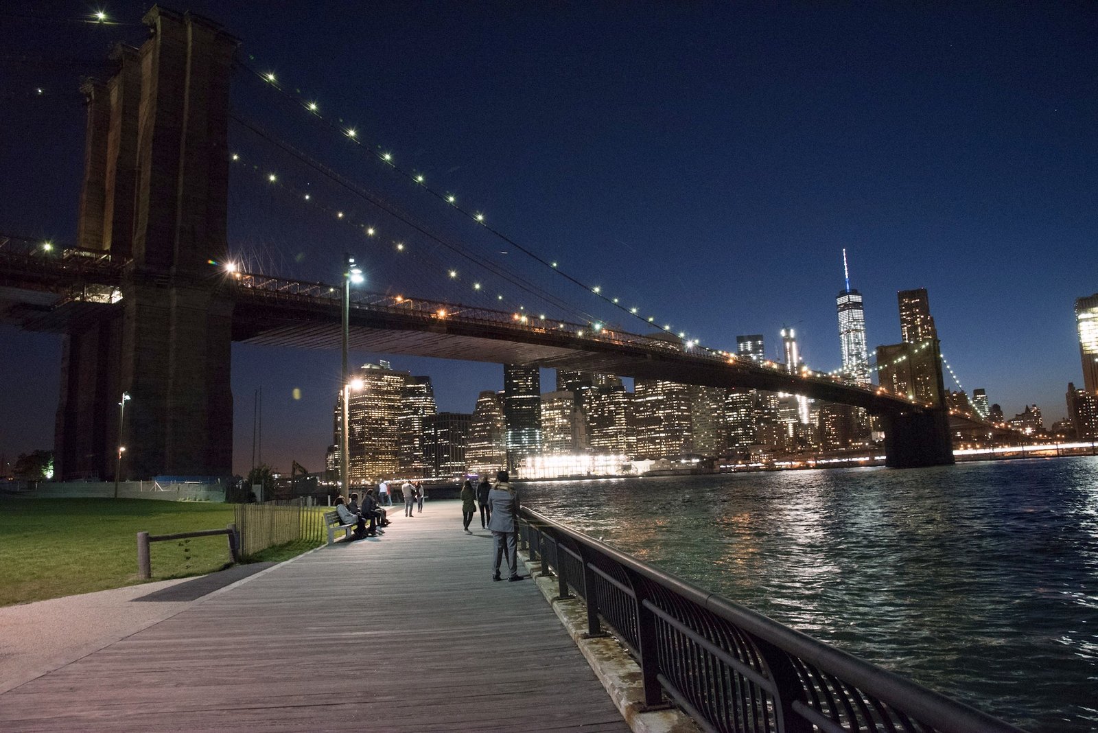
Many of these photographs continue into twilight and full darkness. That progression matters. A sunset collection need not end when the sun disappears; the changing balance between sky brightness and artificial light can produce an entirely different set of images. The pale sky of early evening gives way to a deeper background, and small lights gain visual importance.
Night also introduces limitations. Bright lamps can lose detail while the surrounding buildings remain dark. Boats and people move, and handheld photographs may record camera shake. The photographs here were selected for distinct viewpoints, with similar frames removed. Natural enhancement can improve tone and color, but it cannot turn missing detail into an authentic sharp photograph. I prefer to preserve the character of the original scene rather than invent what the camera did not record.
A Slow Photographic Walk
One useful way to explore is to move between the waterfront and the streets instead of remaining at a single overlook. Begin with a broad river view, then turn toward a façade or a paved intersection. Return to the shore and compare the bridge from another angle. This creates a sequence with variety: an establishing view, an architectural detail, a moment of street life and another panorama.
The famous Washington Street view toward the Manhattan Bridge is one possible stop, but it should not become the whole visit. Look for quieter compositions nearby. Keep to safe pedestrian areas rather than standing in traffic for a photograph. Along the waterfront, use designated paths and respect planted areas and barriers. A successful photograph is not worth blocking access or treating a residential neighborhood as a set reserved for the camera.
Practical Notes for Photographing the Evening
Arrive while there is still enough daylight to understand the scene and choose a comfortable place to stand. Try a wide view first, then simplify: one tower, a section of cable, an arch or a reflection. Check bright areas on the camera display, because a pleasing overall exposure may still lose detail in lamps and windows. If using a tripod is permitted in the specific location, a stable support can help with longer exposures; keep it out of the walking route.
Wind, water and people make each frame different. Take time to review the photograph rather than assuming a recognizable landmark guarantees a clear result. A shorter exposure can help with movement; a deliberate longer exposure can produce a different visual effect. Neither approach is automatically better. Choose the effect that serves the photograph, and keep the distinction between an intentional blur and accidental camera shake honest.
Planning Your Own Visit
Use the official Brooklyn Bridge Park map to choose an entrance and understand how the waterfront spaces connect. The park’s directions list transit options including York Street on the F line, High Street on the A/C lines and the DUMBO/Fulton Ferry landing. Check the relevant operator before departure for current service and access conditions. Hours, construction areas, ferry service and individual businesses can change. [8]
Give yourself time beyond the moment you expect to make your main picture. Comfortable shoes help on uneven paving, and the riverfront may feel cooler than the streets inland. If returning after dark, decide on your route before packing away the camera. Readers using this 2016 collection to plan a visit should treat it as a photographic record and historical introduction, supported by current official visitor information, rather than a guarantee that every photographed path or storefront looks the same today.
Looking Through the Collection
The gallery is arranged as a visual journey from evening skyline views to streets, arches, waterfront paths and illuminated bridges. Each of the 15 gallery photographs presents a distinct composition. Similar frames have been removed so the selection moves between skyline, bridges, streets, architecture and the river without repeating the same view. Selected photographs also accompany the related sections below.
DUMBO is one of the places I return to because it gives me both a familiar view and a reason to look again. The bridges do not move, but almost everything that makes the photograph changes: the light, the clouds, the water, the boats and the people. I hope these images encourage you to enjoy the panorama, notice the working history behind it, and find a view of your own.
Sources and Further Reading
1. NYC Landmarks Preservation Commission: DUMBO Historic District designation report, December 18, 2007 — industrial history, architecture, streets and district boundaries.
2. NYC LPC: DUMBO historic district marker — name, industrial heritage, artists and 2007 designation.
3. Brooklyn Bridge Park: Waterfront history — ferry, cargo and park development history.
4. NYC DOT: Brooklyn Bridge — design, construction and engineering context.
5. Library of Congress: Brooklyn Bridge opening — May 24, 1883 opening.
6. NYC DOT: Manhattan Bridge — 1909 completion and structural history.
7. Brooklyn Bridge Park: Empire Stores — warehouse dates, goods and reuse.
8. Brooklyn Bridge Park: Official map and visitor directions — verify present-day access and transportation.
9. NYC Department of City Planning: DUMBO rezoning context — waterfront geography east of the Manhattan Bridge.
Historical information is supported by the references above. Personal reflections and photographic observations are the photographer’s own. Original photographs © A. Abbady; enhancement preserves the source scenes.